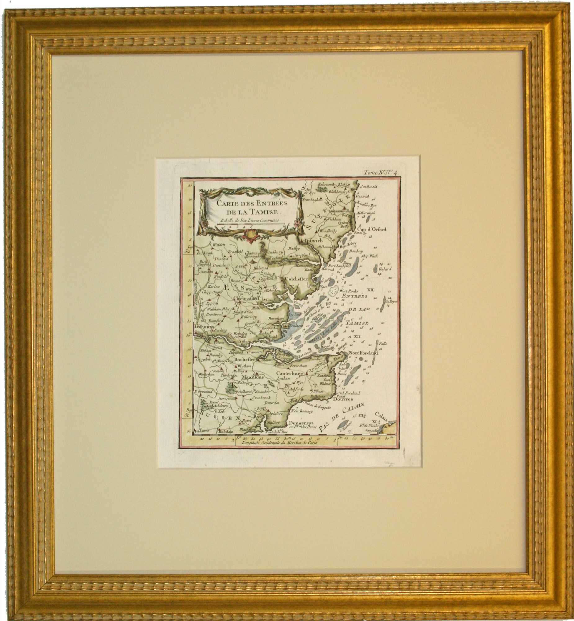
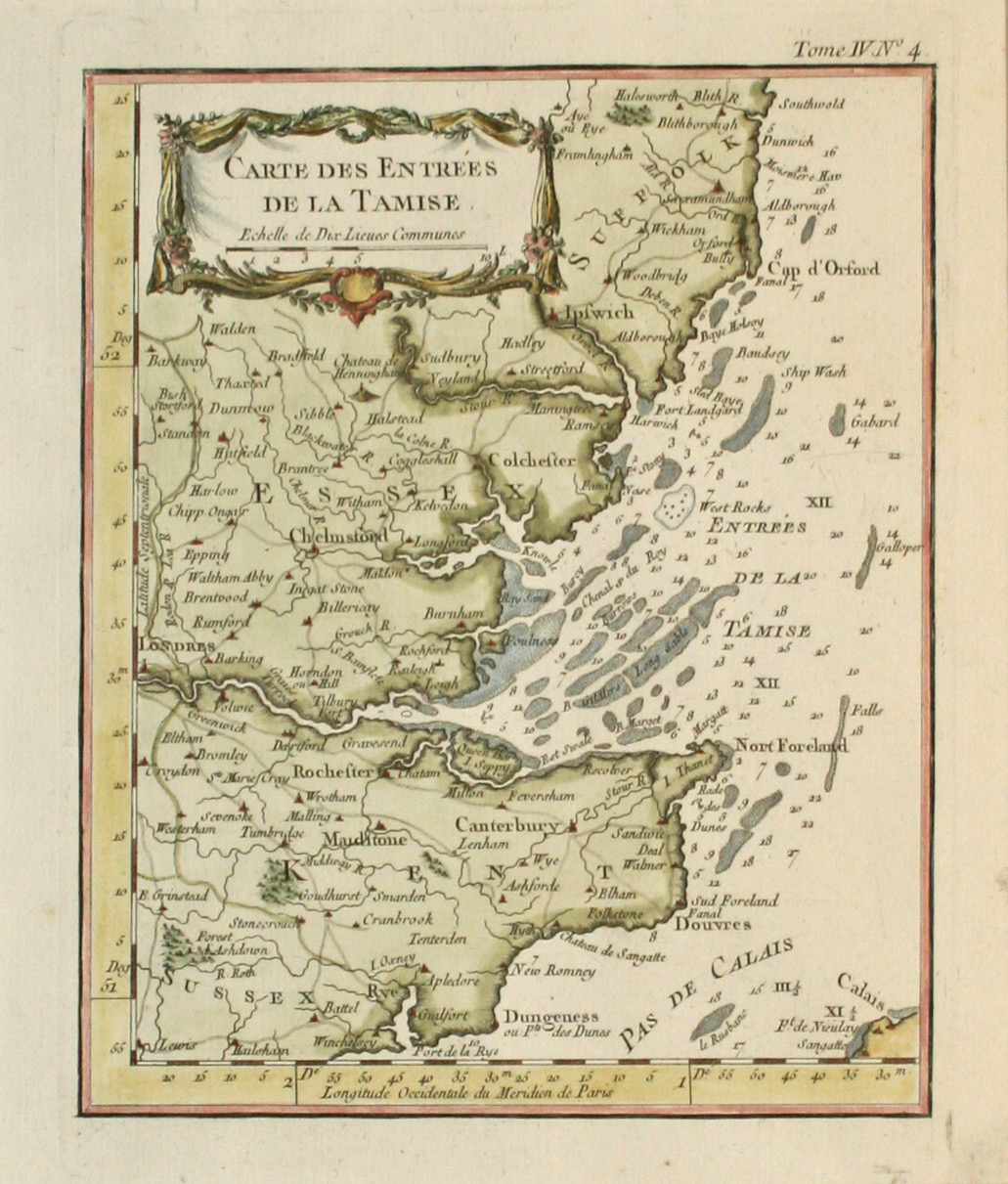
This original map Carte des Entrees de la Tamise, dated 1764, is by Jacques N. Bellin (1730 – 1772) and is from his Petite Atlas Maritime, a five-volume atlas of small maps published in Paris. The map depicts the entrance to the River Thames and has a nice decorative title cartouche at the top of map. This map is in good condition. The framing is done to conservation standards with a museum mat and carved gold frame.